New State of the Art Mapping Service
Welcome to our new mapping department! Statewide Ag has been using a method of GPS mapping for a number of years for their customers. We have taken a step forward and are introducing the use of GIS (Geographic Information System) into our program. With this new system we will be able to create personal databases for individual customers. We make use of the latest technology in order to provide better accuracy and a higher quality of printing. Our central location makes us accessible to any part of South Dakota.
Who can we help?
- Our Customers
- Farmers
- Ranchers
- Cities
- Real Estate Professionals
- Hunting Lodges
- Fire Departments
- Energy Companies
- YOU!
Mapping Services
Here at Statewide Ag we utilize the latest mapping technology for our data collection for sub meter accuracy. We use Trimble Nomad data collectors for our mapping. Our GIS software and plotter are the most up-to-date models. Our large format plotter is capable of printing maps of all sizes up to 34”x44”.
A small list of capabilities we have:
- Custom maps to suit any needs
- Ag field mapping
- Pasture and range mapping
- Imagery maps (hunting, fishing, camping)
- Real estate location map packages
- Large format printing of maps of all sizes
- Pictures in JPEG and PDF format printing
- Scaled Drafting Plan printing
Are You Interest?
Contact Us Today!
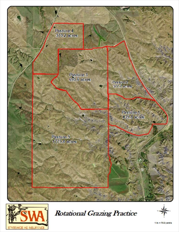
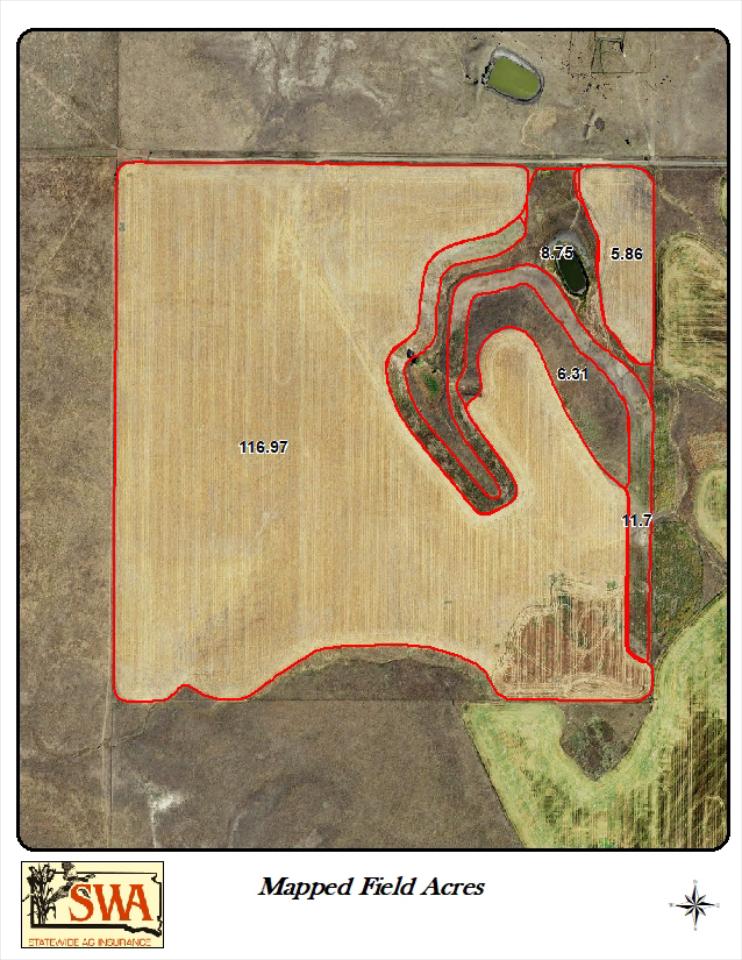
Previews of Maps
- Agriculture Field mapping
- Pasture Mapping
- Large Imagery Maps of Counties or selected areas
- County maps with data
- Hunting Maps